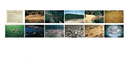
Pardon me for being a little behind the times, but John Baldessari‘s “California Map Project” from 1969 strikes a chord of creativity in me. Maybe we could find a way to blend the scale of this project with the plausibility of our Google Earth rooftop idea. Basically, John Baldessari took a map of California (bottom right) and went to the places where the map letters “California” would be located, and spelled out the letters in rocks or other ways.
From the artist – “Photographs of letters that spell California and of the map used for locating the site of each letter. The letters vary in scale from one foot to approximatly one hundred feet, and in materials used. The letters are located as near as possible within the area occupied by the letters on the map. The idea was to see the landscape as a map and to actually execute each letter and symbol of the map employed on the corresponding part of the earth. It was an attempt to make the real world match a map, to impose a language on nature and vice-versa.”

Interesting to think of correlating maps to the real world in a very literal way, and playing with cartographical representation in physical space. I wonder how much of the space where the letters land on the map is still undeveloped.