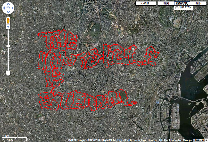
This project, executed by GRL Tokyo, took me a while to figure out. Basically this image, which reads “The Invisible is Eternal,” was made by riding a bike with a GPS device attached to it, then uploading the resulting kml file to Google Maps. It’s pretty insane to see this that this was done on a bike, though aside from that, I’m not sure about it (and the 19 minute video of the condensed bike ride doesn’t help either).
Maybe something is lost in the translation, but I think conceptually, this would have been better as a map made as a kind of algorithm to move the rider over some greater distances than he normally would, then documenting the experience of that process. Of course, in terms of how it was actually executed, that description is probably pretty close, but the reason behind doing it is different (writing / bombing without actually making a mark vs psychogeographic interests), and ultimately kind of dull.
I thought it was worth noting, given some of the Google Earth related projects we’re working on.


This is a pretty neat project. I appreciate the use of GoogleMaps and the GPS to write the text. I think the exercise was an effective way of marking the streets as an ‘eternal text’ or way to communicate. Watching the video made me think how long of a bike ride it must have been, and how many times he must have practiced it to get it right.
sweet.
ps. welcome home!
see you tomorrow!