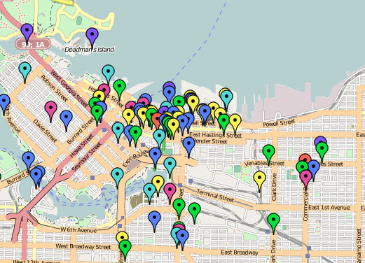
In a rather large-scale collaborative mapping project, artist Althea Thauberger and some of her colleagues are attempting to assemble an alternative tour guide, or rather, a (de)tour guide for visitors to Vancouver while the 2010 Olympic games are underway.
They set it up like this, “For us, it is vital to complicate the sanitized ‘best place on earth’ version of the city VANOC is officially promoting worldwide […] Since Google maps will be the information source of choice to visitors, we are interested in using it as a tool to critically contextualize the city during this high-profile period.”
Exploring the map provides a wide variety of points of interest, some quite interesting, others less so. The map seems to provide the most engaging information when acting as guide to local activist history, with those markers providing some spatial context for what’s happened as a grassroots political level over the last number of years (though it would be interesting to see those in relation to current Olympic-occupied places). However, as a whole, the map is a bit too unfocused to provide any really useful or critical information (and perhaps as a disinformation campaign acting in opposition to the Olympics’ official maps and points of interest, it is most successful).
Conceptually, the goal of the project to reach the front pages of Google when one searches for things to do in Vancouver is quite intriguing — I can imagine that nearly all other information one might come into contact with while in the city during this time will be stamped as an official 2010 Olympics piece of merchandise — it may be that adding suggested routes for specifically-themed tours might be a way for providing some organizational structure for all of this information.
[via an email from Josh, who we met at the Propeller show]
