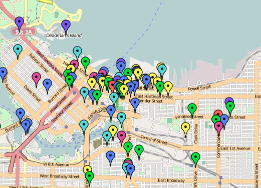
Vancouver [de]Tour Guide 2010

In a rather large-scale collaborative mapping project, artist Althea Thauberger and some of her colleagues are attempting to assemble an alternative tour guide, or rather, a (de)tour guide for visitors to Vancouver while the 2010 Olympic games are underway.

They set it up like this, “For us, it is vital to complicate the sanitized ‘best place on earth’ version of the city VANOC is officially promoting worldwide […] Since Google maps will be the information source of choice to visitors, we are interested in using it as a tool to critically contextualize the city during this high-profile period.”

Exploring the map provides a wide variety of points of interest, some quite interesting, others less so. The map seems to provide the most engaging information when acting as guide to local activist history, with those markers providing some spatial context for what’s happened as a grassroots political level over the last number of years (though it would be interesting to see those in relation to current Olympic-occupied places). However, as a whole, the map is a bit too unfocused to provide any really useful or critical information (and perhaps as a disinformation campaign acting in opposition to the Olympics’ official maps and points of interest, it is most successful).

Conceptually, the goal of the project to reach the front pages of Google when one searches for things to do in Vancouver is quite intriguing — I can imagine that nearly all other information one might come into contact with while in the city during this time will be stamped as an official 2010 Olympics piece of merchandise — it may be that adding suggested routes for specifically-themed tours might be a way for providing some organizational structure for all of this information.

[via an email from Josh, who we met at the Propeller show]

Google Street View is Coming to Windsor

streetview

Google’s Street View service is making the rounds across Canada. There’s no schedule that I’ve been able to find yet, but they are coming to Windsor.

Anyone have any ideas about when Google is coming to town?

And maybe as a follow up, anyone have any ideas?

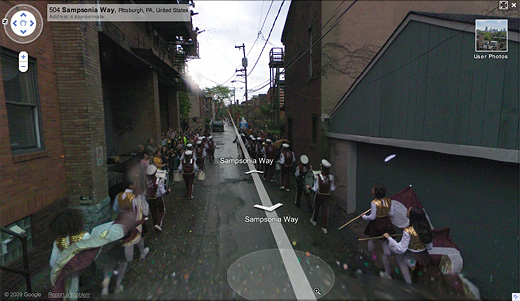
There’s already a short history of artists working alongside Google’s team. In 2008, artists Robin Hewlett and Ben Kinsley invited the Google Inc. Street View team and residents of Pittsburgh’s Northside to collaborate on a series of tableaux (pictured above), but to not at least think about doing something would certainly be a waste. How often do you think this could possibly happen?

I wonder if a well-placed, but legible, banner might be worth investigating?

[via CBC]

Graffiti Using GPS

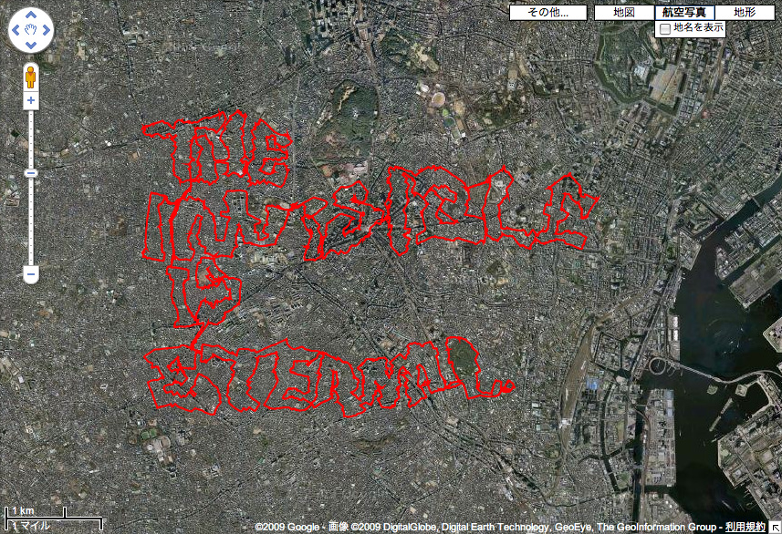
Invisible Bombing, GRL Tokyo

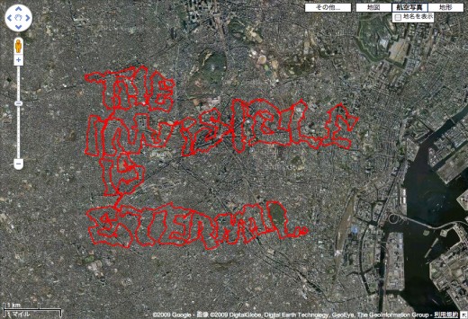
This project, executed by GRL Tokyo, took me a while to figure out. Basically this image, which reads “The Invisible is Eternal,” was made by riding a bike with a GPS device attached to it, then uploading the resulting kml file to Google Maps. It’s pretty insane to see this that this was done on a bike, though aside from that, I’m not sure about it (and the 19 minute video of the condensed bike ride doesn’t help either).

Maybe something is lost in the translation, but I think conceptually, this would have been better as a map made as a kind of algorithm to move the rider over some greater distances than he normally would, then documenting the experience of that process. Of course, in terms of how it was actually executed, that description is probably pretty close, but the reason behind doing it is different (writing / bombing without actually making a mark vs psychogeographic interests), and ultimately kind of dull.

I thought it was worth noting, given some of the Google Earth related projects we’re working on.

My Neighbourhood; A Tag Project

tagging_project

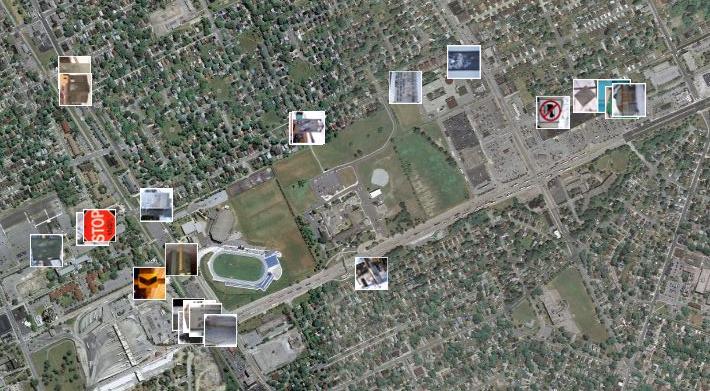
With the help of Panoramio, a site that allows users to upload images and plot them using Google Maps, I created a project where I mapped the routes that I walk on a weekly basis. I did this by photographing the tags I see on my walks, then plotting the images on the map. There are three main taggers in my neighbourhood; Beast, THC and Jerk. I tagged the appropriate photos on Panoramio with the names of these taggers. I plan on extending this project to include more images of tags in other neighbourhoods around Windsor and opening it up to others to contribute their images as well.

Check out the photos here.

More BCL+maps